
I got an interesting email today and wanted to put this out there and see if there is any interest.
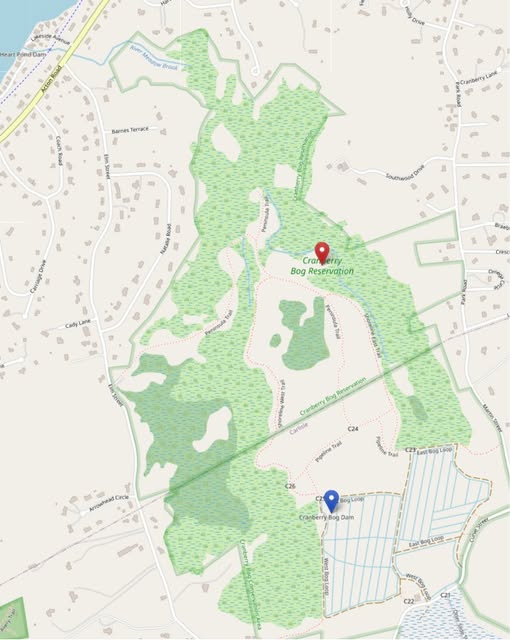
I was asked if I would be willing to lead a walk-out at the cranberry bog and talk through what is actually going on with the water out there. Not just the main dam, but the full system.
I have been walking that area for about 20 years now. I have been there during multiple breaches, seen the changes over time, and followed the increase in beaver activity. Furthermore, I have seen it in high water and low water and spent a lot of time just watching how it all moves.
I am not an expert, but I do know the land.
What most people do not realize is that the Chelmsford side is not controlled by a single dam. It is really a connected system. The trail itself follows a string of old berms and small control points from the cranberry days that still help form one side of the pond. Upstream there is a large beaver dam that holds water before it even reaches the main structure. Then you have the town-maintained dam that has gone through town meeting funding and repairs over the years.
All of this ties directly into what is happening on the Carlisle side as well. It is one system that crosses the town line, and everything is connected.
A lot of what I know about this area is not from reading reports; it is from being out there and seeing it firsthand over time.
I have been out there in high water and low water. I have seen periods where there were fish die-offs that required the bog to be closed. Not only that, but I have watched beaver activity change the flow and even contribute to roadway collapses. Likewise, I have seen leaks develop in the berms and watched new beaver dams raise water levels to within inches of overtopping some of those old structures.
I have walked areas above the Carlisle Dam and even out to the island during times when the water was low enough to access them. In the winter, when everything is frozen, I have explored sections that you simply cannot get to any other time of year.
That kind of access over time gives you a very different perspective on how this system actually behaves.
Over the years I have also spent time speaking to bird watchers and wildlife folks out there. On a good day they have counted as many as 500 birds on the pond, so there is a lot more going on than just water levels.
If I do this, it would be a simple walk, probably a Sunday morning around 8am, about an hour and a half. Most of it is easy walking. There is one section that can be wet if we go out to the beaver dam, and that is usually where people turn back, so they never actually see it.
I would also plan to put together a short video ahead of time so people have some context before the walk.
This would just be me sharing what I have seen over 20 years so people can better understand how complex the system really is and how all the dams, berms, and natural activity are intertwined between Chelmsford and Carlisle.
If there is interest, please let me know, and I will set something up.