
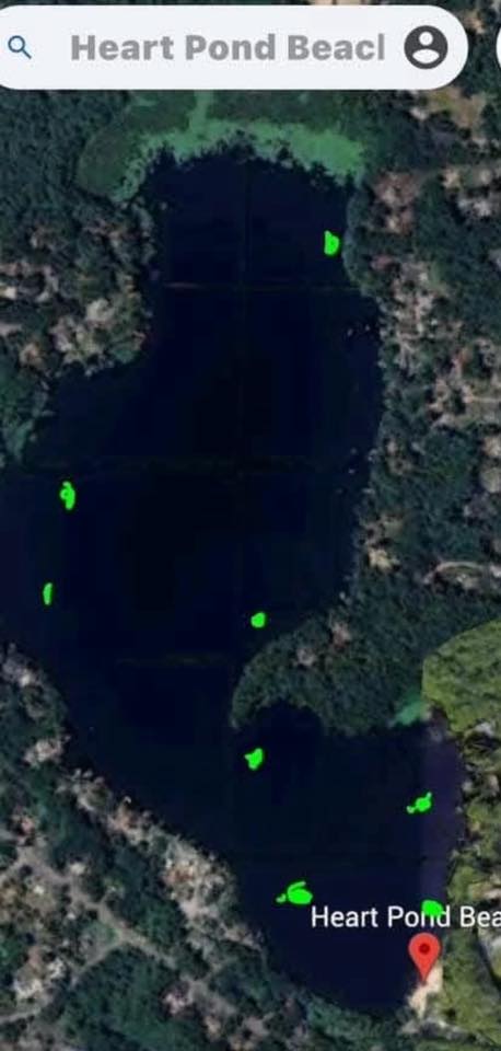
Over the years, several people have shared local knowledge about Heart Pond and where ice is often thinner due to springs, groundwater movement, or subtle current. The attached image is a user-made reference map that marks areas that have historically been reported as thin ice.
This map does not guarantee accuracy. It is not official. It is not surveyed. It should not be used to determine whether the ice is safe.
Ice conditions change constantly. Thickness can vary greatly across the pond, even within a few feet. Cold nights, warm days, rain, snow cover, and groundwater flow all affect ice strength. New thin areas can appear at any time, including areas not shown on this map.
This is simply being shared as local knowledge so people understand why Heart Pond can be unpredictable in winter and why some areas may remain unsafe even when the pond looks fully frozen.
We are not saying the ice is safe now or at any time. Anyone choosing to go on the ice does so at their own risk.
General winter ice reminders
• Never assume ice is safe based on appearance
• Ice thickness is not uniform
• Springs and moving water weaken ice
• Conditions change daily
• When in doubt, stay off the ice
If you have questions about winter access or want to share additional historical observations, feel free to comment. Sharing information helps people make better personal decisions, but it does not replace caution or common sense.
This update was reviewed for 501(c)(3) compliance and no issues were identified.